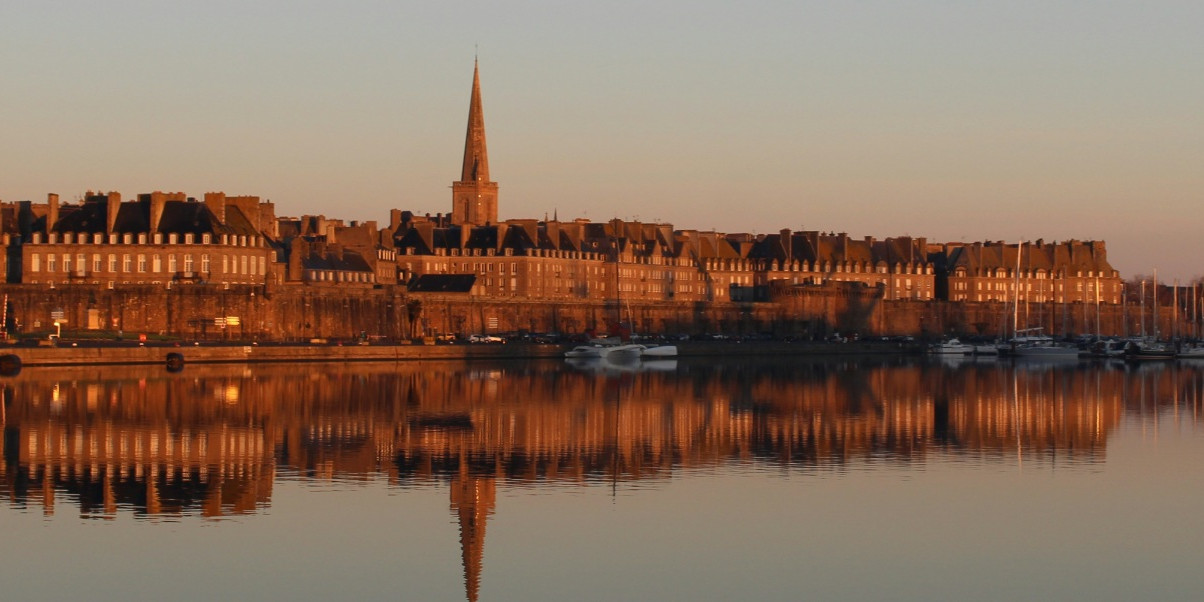
The history of Saint-Malo is inseparable from that of privateers.
The city is full of remnants of its military past, such as the ramparts—discover this Saint-Malo map to uncover all its secrets.
It also boasts natural treasures, including coves and the iconic high tides.
Where is Saint-Malo located?
The city of Saint-Malo is situated in the northern part of the Ille-et-Vilaine department in Brittany.
A bit further south are the towns of Dol-de-Bretagne and Combourg, approximately 28 km and 42 km from the privateer city via the Liberty Route.
Located in central Ille-et-Vilaine, Rennes is about 70 km away via the D137.
We can also provide you with a detailed map of Ille-et-Vilaine.
Detailed map of Saint-Malo
The cultural richness of Saint-Malo makes it an ideal destination for a family vacation.
Here is the map of Saint-Malo highlighting some of the city's most iconic sites:
- The Privateer Frigate L’Etoile du Roy: L’Etoile du Roy is a faithful replica of an 18th-century privateer ship. Moored along the Duguay-Trouin quay, the frigate is now a floating museum. Guided tours are regularly organized to help visitors learn more about the daily lives of the two hundred sailors who lived on board. More broadly, it’s an opportunity to discover the activities of privateers of the past. These privateers were officially commissioned by public authorities to attack foreign ships, including merchant vessels. This distinction from pirates is noteworthy: acting within the bounds of the law, privateers were often members of the Breton upper middle class.
- Malouinière de la Ville Bague: From early April to late September, the Malouinière de la Ville Bague is open to the public, tourists, and locals. The manor was the countryside residence of Jean-Baptiste Colbert, founder of the French East India Company. In addition to the manor, the estate includes a pond, a dovecote, a small chapel, and a well-maintained garden. Guided tours begin at 2:30 PM and 4:00 PM, each lasting approximately 90 minutes.
- Museum of History of the City and Malouin Country: The museum, a well-preserved old castle, presents the history of Saint-Malo. Exhibits are organized chronologically, allowing visitors to understand the city's dependence on maritime trade over time. The museum displays over 8,000 objects, including artworks, liturgical items, sailors’ tools, and historical documents. Some visitors can’t resist climbing to the top for a breathtaking panoramic view of the city and the bay.
- The Ramparts of Saint-Malo: The ramparts form a 1.75 km-long belt protecting the old part of Saint-Malo. Their construction began in the 12th century and was reinforced in the 16th and 18th centuries. From the walls, you can admire Grand-Bé Island and Fort National. It’s also the perfect vantage point to observe Dinard and the beautiful granite mansions of the city’s wealthy shipowners.
- The Old Town: The corsair city is proud of its many gray granite houses. Its intra-muros neighborhood is characterized by picturesque cobblestone streets lined with restaurants, cafes, bars, high-end shops, and crêperies. Many of the old town’s houses, in the eastern part of Saint-Malo, are built into the medieval fortifications. The oldest part of the corsair city is a pleasant place for a stroll with family, friends, or solo.
- The Sillon Beach: The Sillon Beach offers 3 kilometers of fine sand stretching north of the fortified city. It is bordered by a large embankment dating back to the 20th century and extending over 1.5 km, providing a pleasant walkway for both visitors and residents. In summer, families flock to swim in the shallow rock pools on the western edge near Fort National. Discover all the most beautiful beaches of Saint-Malo.
Other tourist attractions include the popular Saint-Malo Aquarium, the seafront at low tide, the historic center, the thermal baths, Mont-Saint-Michel, or the Chateaubriand estate.
